DETROITography

Menu

Skip to content
  • About
  • Our Maps
  • Events
  • Neighborhoods
  • Resources
  • Find Data
  • Learn
  • Participate

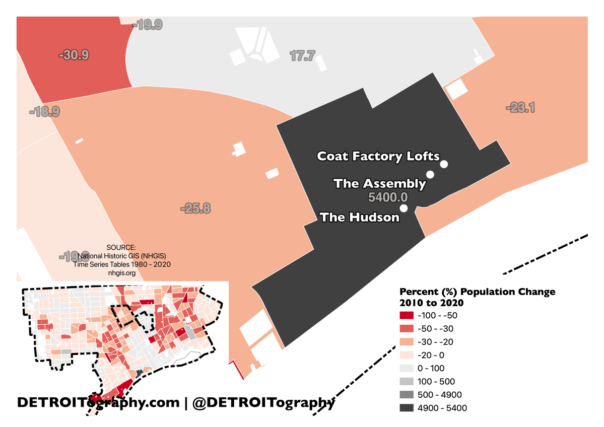
detroit_pop_5400pct

Published May 30, 2023 at 3507 × 2480 in Map: Exploring Detroit Population Change from 2010 to 2020
← Previous Next →

Share this:

  • Click to share on Bluesky (Opens in new window) Bluesky
  • Click to share on LinkedIn (Opens in new window) LinkedIn
  • Click to share on Nextdoor (Opens in new window) Nextdoor
  • Click to email a link to a friend (Opens in new window) Email
  • Click to share on Facebook (Opens in new window) Facebook
  • Click to share on X (Opens in new window) X
  • More
  • Click to print (Opens in new window) Print
  • Click to share on Reddit (Opens in new window) Reddit
  • Click to share on Pinterest (Opens in new window) Pinterest
Like Loading...
Trackbacks are closed, but you can post a comment.

Leave a comment Cancel reply

Create a website or blog at WordPress.com

Contact

Submit a map or just get in touch. Thanks for following!
hello@detroitography.com
×
  • Comment
  • Subscribe Subscribed
    • DETROITography
    • Join 629 other subscribers
    • Already have a WordPress.com account? Log in now.
    • DETROITography
    • Subscribe Subscribed
    • Sign up
    • Log in
    • Copy shortlink
    • Report this content
    • View post in Reader
    • Manage subscriptions
    • Collapse this bar
%d