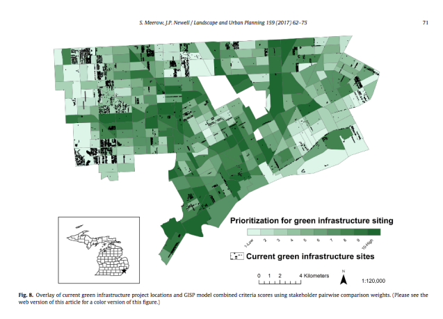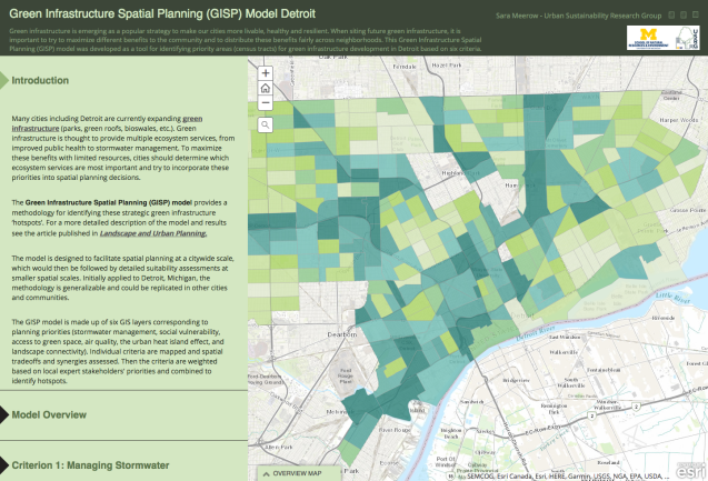
The Green Infrastructure Spatial Planning (GISP) model created by Sara Meerow of the University of Michigan Urban Sustainability Research Group provides a methodology for identifying strategic green infrastructure ‘hotspots’.
The GISP model is made up of six GIS layers corresponding to planning priorities (stormwater management, social vulnerability, access to green space, air quality, the urban heat island effect, and landscape connectivity). Individual criteria are mapped and spatial tradeoffs and synergies assessed. Then the criteria are weighted based on local expert stakeholders’ priorities and combined to identify hotspots.
From her published research, Meerow also found that current green infrastructure efforts did not match with her model’s hotspots.