In 1970, William Bunge’s Detroit Geographic Expedition compared the neighborhood assets in two different communities: Mack Avenue in Detroit and an area of Bloomfield Hills.
From the MIT Civic Media Center:
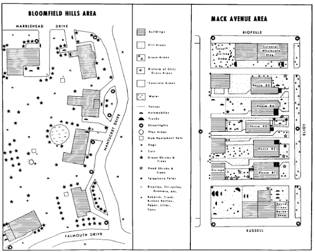
[…] Field Notes III contains more qualitative data in the form of personal accounts, ethnographic interviews, and testimonials. Gwendolyn Warren mapped the 21 homes she inhabited growing up and provided harrowing details of rat-infested tenements and their impact on the children in her family. A team of researchers conducted interviews with children on playgrounds in a predominantly white neighborhood and a predominantly black neighborhood, detailed their own observations of the two places, and mapped the visual aspects of the two neighborhoods to characterize the relative dangers and affordances of children’s lives in each.
This reminds me of a more modern example of inequality from space by Tim de Chant, see more: Detroit Inequality from Space

Pingback: Map: Trumbull Households Displaced by Urban Renewal 1971 | DETROITography
Pingback: Map: Acres of Park and Playfield Space in Detroit 1972 | DETROITography